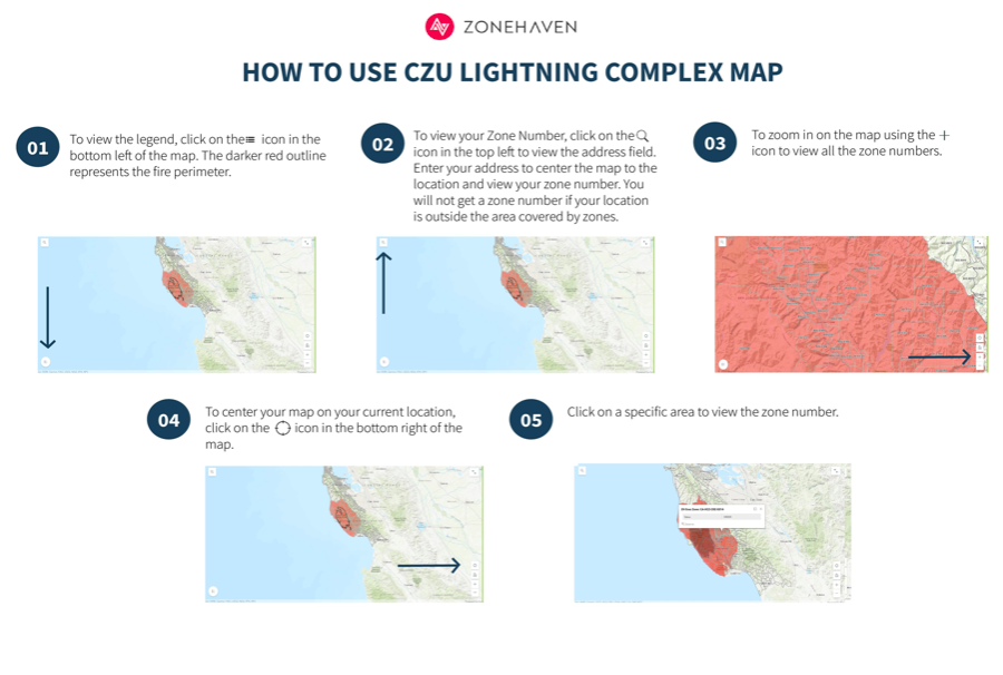
How to use Evacuation Map (zonehaven)
CAL FIRE and emergency services are using ZoneHaven for evacuation maps. These are the official maps used by San Mateo County for emergency response.
https://smco.community.zonehaven.com
If you are having difficulties using the map, please see the instructions below.