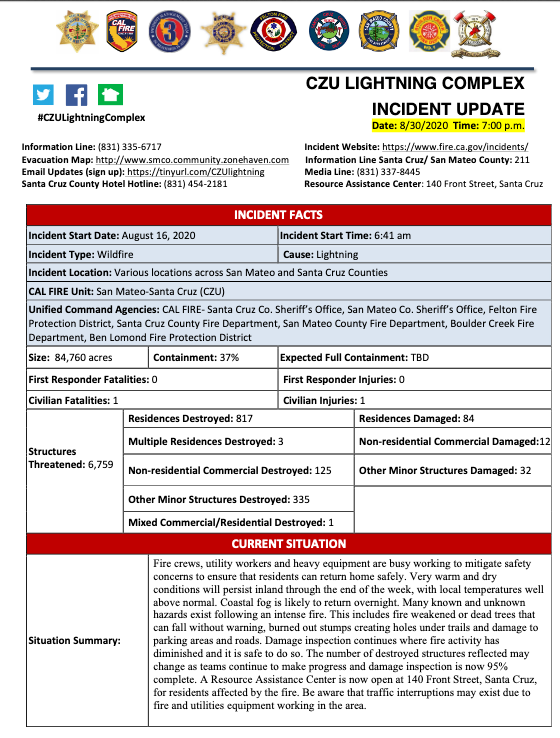
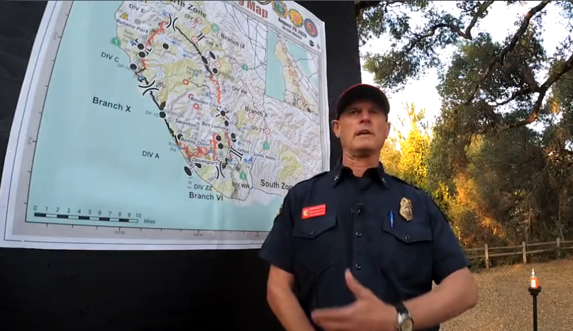
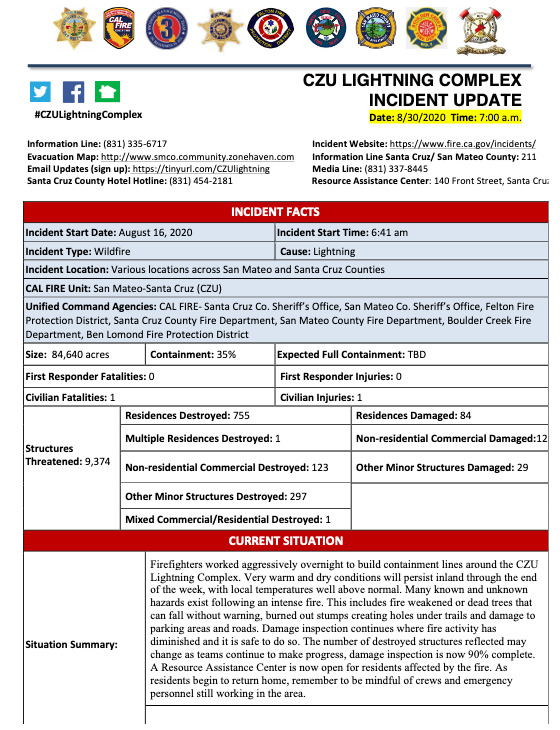
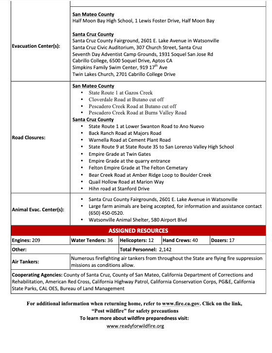
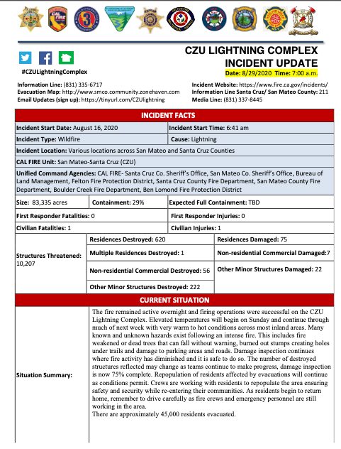
INCIDENT UPDATE: CZU LIGHTNING COMPLEX, AUG 30, 2020, 7PM
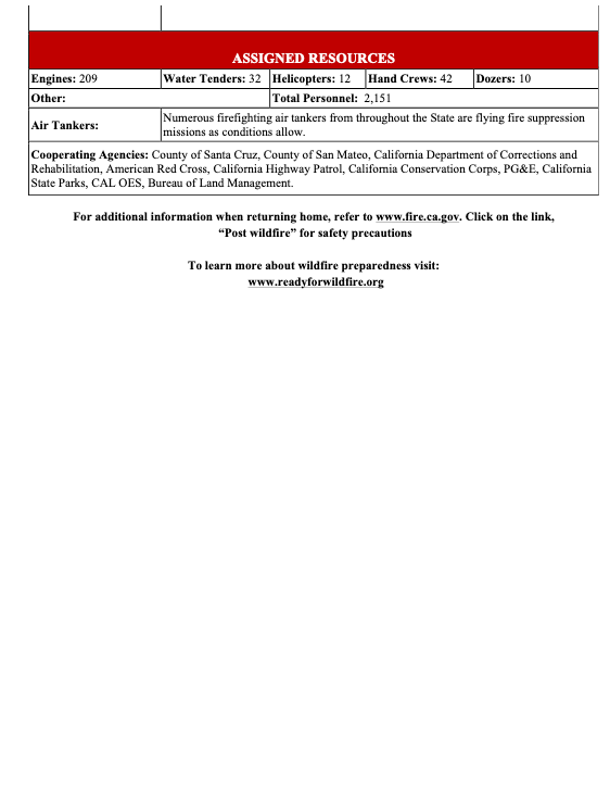
Incident Website: https://www.fire.ca.gov/incidents/
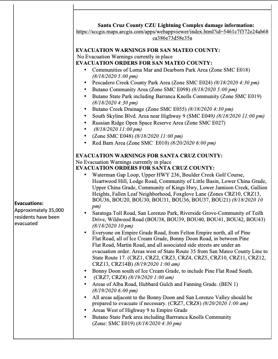
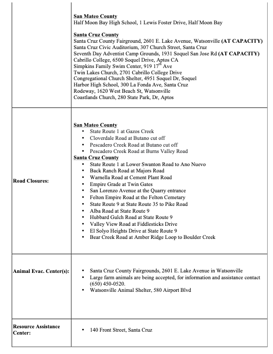
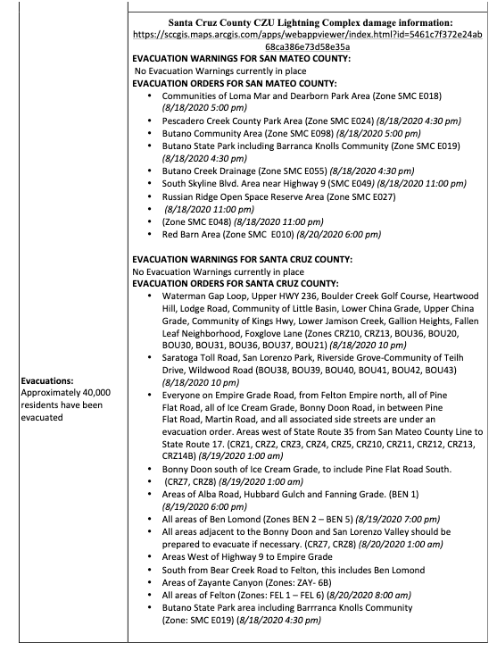
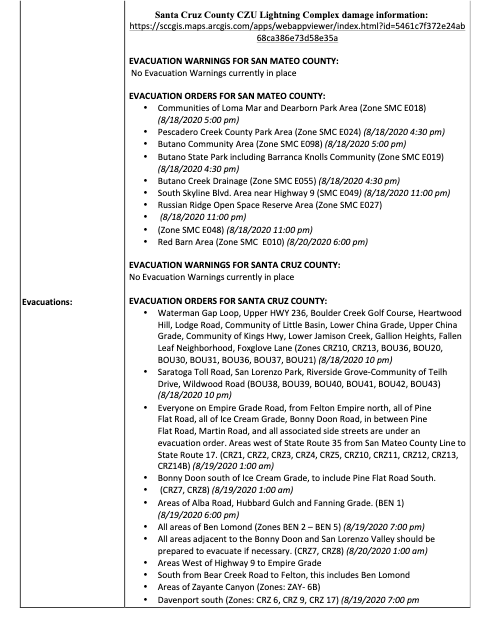
Evacuation and Repopulation Map:www.smco.community.zonehaven.com
Link to press conference (in English):https://www.pscp.tv/CALFIRECZU/1BRJjYLVjLpGw